
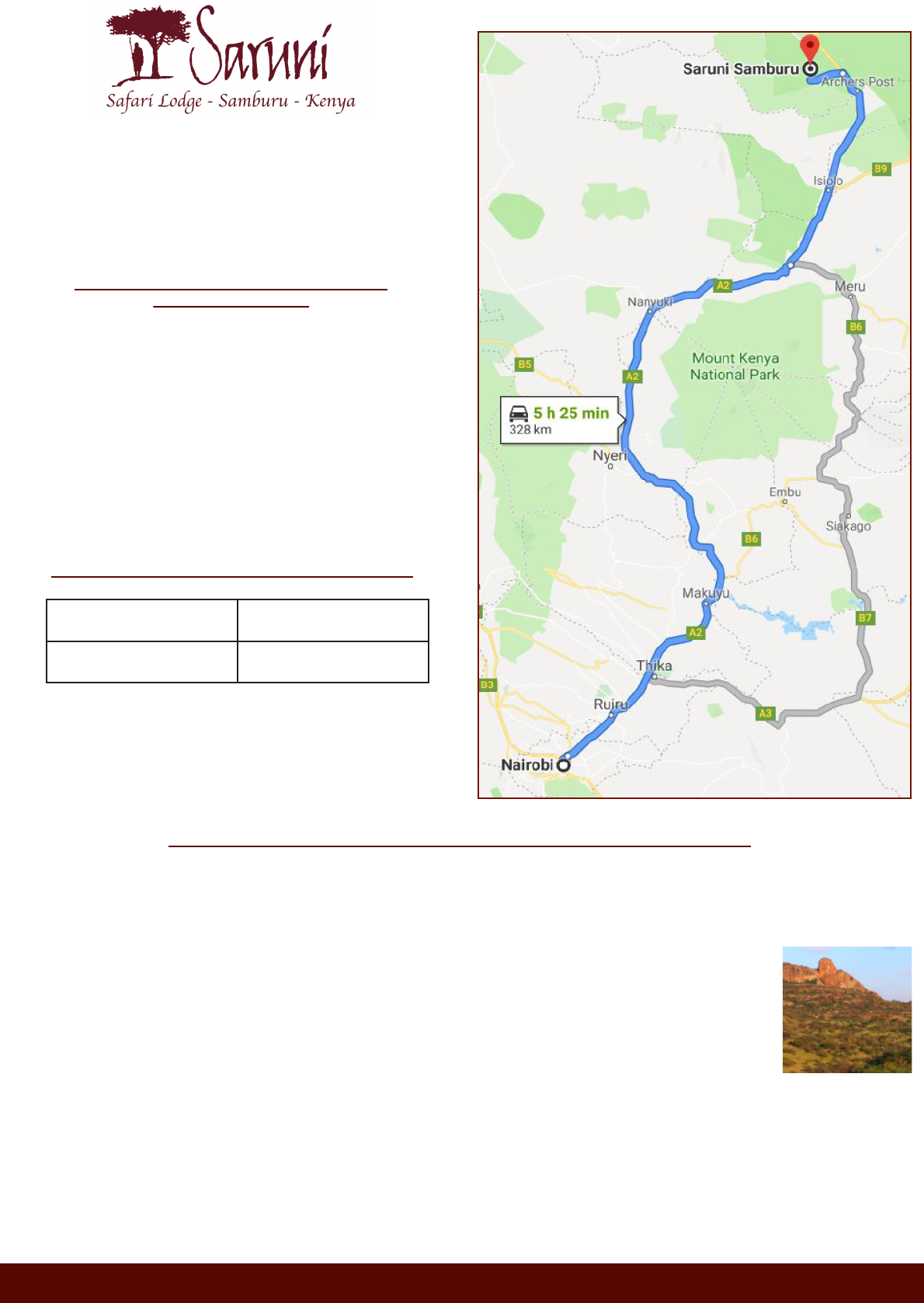
Saruni Samburu Driving Directions
KENYA
Nyeri
Nanyuki
Isiolo
Archers Post
NAIROBI (CBD)
Meru
SARUNI SAMBURU
Mt. Kenya
National
Park
Aberdare
National
Park
Lake Turkana
Sera
Conservancy
Trust
Namunyak
Wildlife
Conservation
Trust
Kalama
Community
Conservancy
Leparua
Community
Conservancy
• At Archer’s Post stay on the highway and keep North; do not enter the Samburu National Reserve and
do not go through the Archer’s Post gate;
• At exactly 8 km after Archer’s Post, down on the left‐hand side, you will see a sign that reads: ‘Kalama
Conservancy/Saruni Camp’, leave the main road and go through the Kalama Conservancy gate;
Nairobi (CBD) to Thika
Thika to Makuyu
Makuyu to Karatina
Nanyuki to Isiolo
Isiolo to Archer’s Post
44.0 km
28.6 km
64.3 km
79.5 km
34.6 km
APPROXIMATE DISTANCE BETWEEN TOWNS
ALONG THE HIGHWAY
Karatina to Nanyuki
68.0 km
DRIVING DIRECTIONS TO
SARUNI SAMBURU FROM NAIROBI
APPROXIMATE TIME: 5-6 HRS
From Archer’s Post, follow the below instructions to Saruni Samburu
T +254 (0)202 180 497 M +254 (0)735 950 903 E reservations[email protected]m W www.saruni.com
Lodge GPS and Google Earth Coordinates
Lodge GPS Coordinates N 0°42’21”, 37°31’52” E
Coordinates
00.705275, 037.531111
• Drive STRAIGHT down the road and you will soon see a stone signage ‘Saruni. Welcome
to Saruni Airstrip’, with a road off to the right. Pass this and continue STRAIGHT;
• At the next junction turn RIGHT. There is no sign;
• Continue STRAIGHT down the main road (following our tractor tracks towards the lodge);
• A seldom used road will form a crossroads with your road. Ignore this and continue STRAIGHT;
• You will then have to cross a large dry river bed/lugga;
• When you come to another junction with a stone signage ‘Saruni. The Loop’ continue STRAIGHT along
the main track (veer LEFT);
• You will soon come across a sign saying ‘Saruni 2 km’ at the next junction. Go STRAIGHT (veer RIGHT);
• From here, follow the most used road all the way to the lodge which should appear on a rocky hill, in
front of you to the LEFT.
The distance between Kalama gate and Saruni is 12 km, follow the main dirt road, keeping
the distinctive Thumb Rock, pictured on the right, as a reference point;
•
Karatina
